 by
by 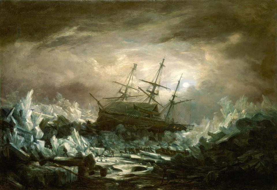
The HMS Terror, depicted here in an 1838 painting by William Henry Smyth, became trapped in the ice west of Baffin Island and stranded on an ice floe for 118 days during an Arctic voyage, one of many casualties in the search for a way to circumnavigate the world. (Royal Museums Greenwich)
The search for a Northwest Passage fundamentally marked the history of Newfoundland, where John Cabot landed in 1497 while searching for a northwest sea route to Asia.
Although European sailors equipped themselves with the latest marine technologies, from agile caravels to magnetic compasses, their faith in the existence of a Northwest Passage was based on something much less modern: 1,800-year-old theoretical geography.
Taking as evidence only ancient philosophy and the Bible, Europeans were certain that a navigable, ice-free Northwest Passage must exist, and their quest to find it would last centuries and cost hundreds of lives.
A symmetrical world
When Europeans first set sail for uncharted waters, they had to rely on theory, rather than experience, to guide them.
Although the Vikings had arrived on the island of Newfoundland about 500 years earlier, detailed knowledge of this territory beyond Greenland had not spread to other Europeans. Meanwhile, Marco Polo’s account of his voyages through Asia had done little to clarify how those lands could be reached by sailing west from Europe.
With so little to do, would-be explorers relied on the most up-to-date guesses about what lay beyond the horizon. These predictions were based on sources that, by our modern standards, were far from scientific: ancient philosophy and Christian theology.

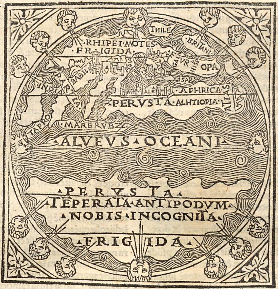
The 8th century Mappa Mundi d’Albi shows a symmetrical idealization of the world as medieval Europeans knew it. The map is centered on the Mediterranean, with the Middle East at the top, Europe on the left, and North Africa on the right. (Médiathèque d’Albi-Centre Pierre-Amalric)
One of the few ancient texts dealing with geography that survived in Western Europe after the fall of the Roman Empire was that of Plato. Timaeus.
According to the Timaeus, a divine creator designed our universe following mathematical principles of balance and proportion. The very fact that the Earth is a sphere (“of all forms, the most perfect”, “the form that contains in itself all other forms”) is evidence of its physical impeccability.
The Old Testament seemed to corroborate Plato’s views. The Book of Isaiah describes creation as an act of precise calculation performed by a god who “weighed the mountains in scales and the hills in scales,” who “measured the waters with the hollow of his hand, measured the heavens with a span, and He calculated the dust of the earth in one measure.”
If the Earth was created in divine balance, according to medieval and Renaissance thought, it was logical that its oceans and continents should be arranged symmetrically and in proportion to each other.
When 15th-century explorers brought news from the Americas to Europe, it confirmed what most geographers already believed: that the continent of Afro-Eurasia must have a counterpart of equal size on the opposite side of the globe.
The upper half of this 1489 world map from a Venetian edition of John of Eschenden’s Summa astrologiae judicialis shows Eurasia and Africa separated by the Ocean Current from a presumed southern continent of equal size. (University of Seville Library.)
In 1487, Portuguese explorer Bartolomeu Dias rounded the Cape of Good Hope (the southernmost point in Africa) to reach the Indian Ocean, and in 1520, his compatriot Ferdinand Magellan sailed a strait across the southern tip of South America. to the Pacific Ocean.
According to the prevailing theory of symmetrical geography, these voyages demonstrated the existence of southwestern and northeastern passages. If there were sea routes open to the south of the world’s continents, there must also be sea routes open to the north.
The magician who trained the explorers of England
Sixteenth-century English explorers received a thorough education in the principles of theoretical geography before setting sail, taught by none other than the famous occultist John Dee.
As an advisor to Elizabeth I, Dee’s astrological forecasts, communications with angels, and mystical writings earned him the nickname “the Queen’s conjurer” and he tutored the leaders of all English expeditions to the northern waters in the second half of the 16th century, including Martin Frobisher, Humphrey Gilbert and John Davis.
Steeped in ancient philosophy and Christian Kabbalism, he taught them the theory of symmetrical geography and used philosophical reasoning to justify the search for a Northwest Passage.
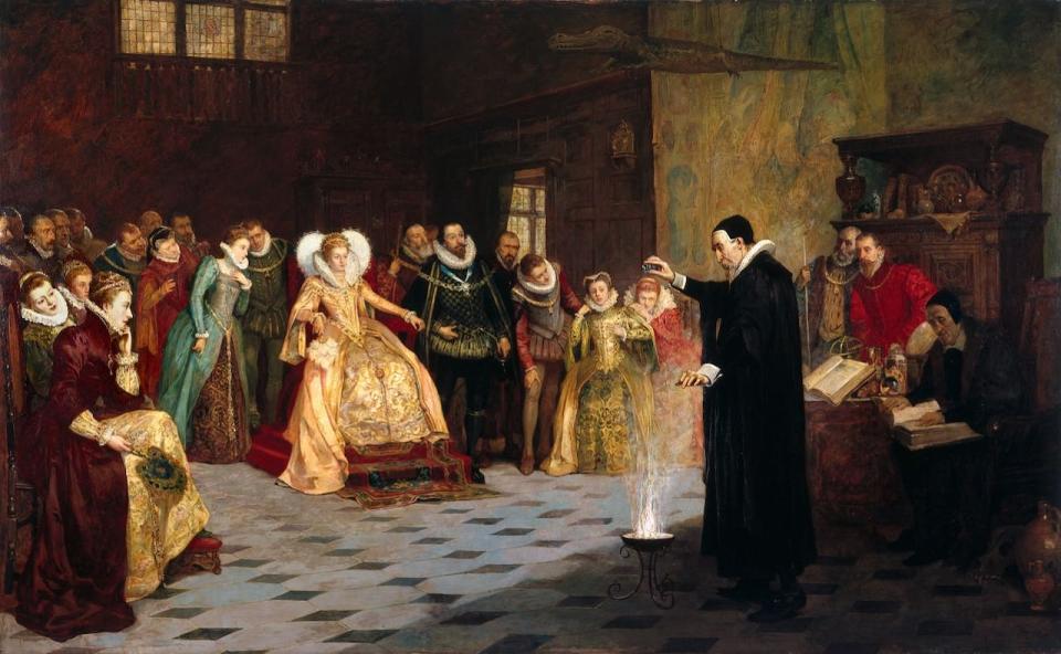
John Dee performs an experiment before the English court in an oil painting by Henry Gillard Glindoni. (Welcome Collection)
As strange as it may seem that a sorcerer would have so much influence over English exploration, Dee’s influence demonstrates the fine line between magic and science at the time. Although he may have been fascinated by mysticism, Dee was, above all, a mathematician.
He used his mathematical talent not only to draw up horoscopes and practice numerology, but also to make astronomical observations, study Euclidean geometry, and develop new navigation instruments.
What we now consider natural sciences were, from the 4th century BC to the 19th century, classified as “natural philosophy” and considered a branch of philosophy in general, just another way of trying to better understand the world through observation and the observation. reason.
The theory of a symmetrical Earth continued to drive exploration of the Canadian Arctic until Franklin’s failed expedition of 1845-48. The two ships of him, the Terror and the ErebusThey were encased in impenetrable ice for three years, resulting in the deaths of all 129 crew members from scurvy, starvation, and exposure.
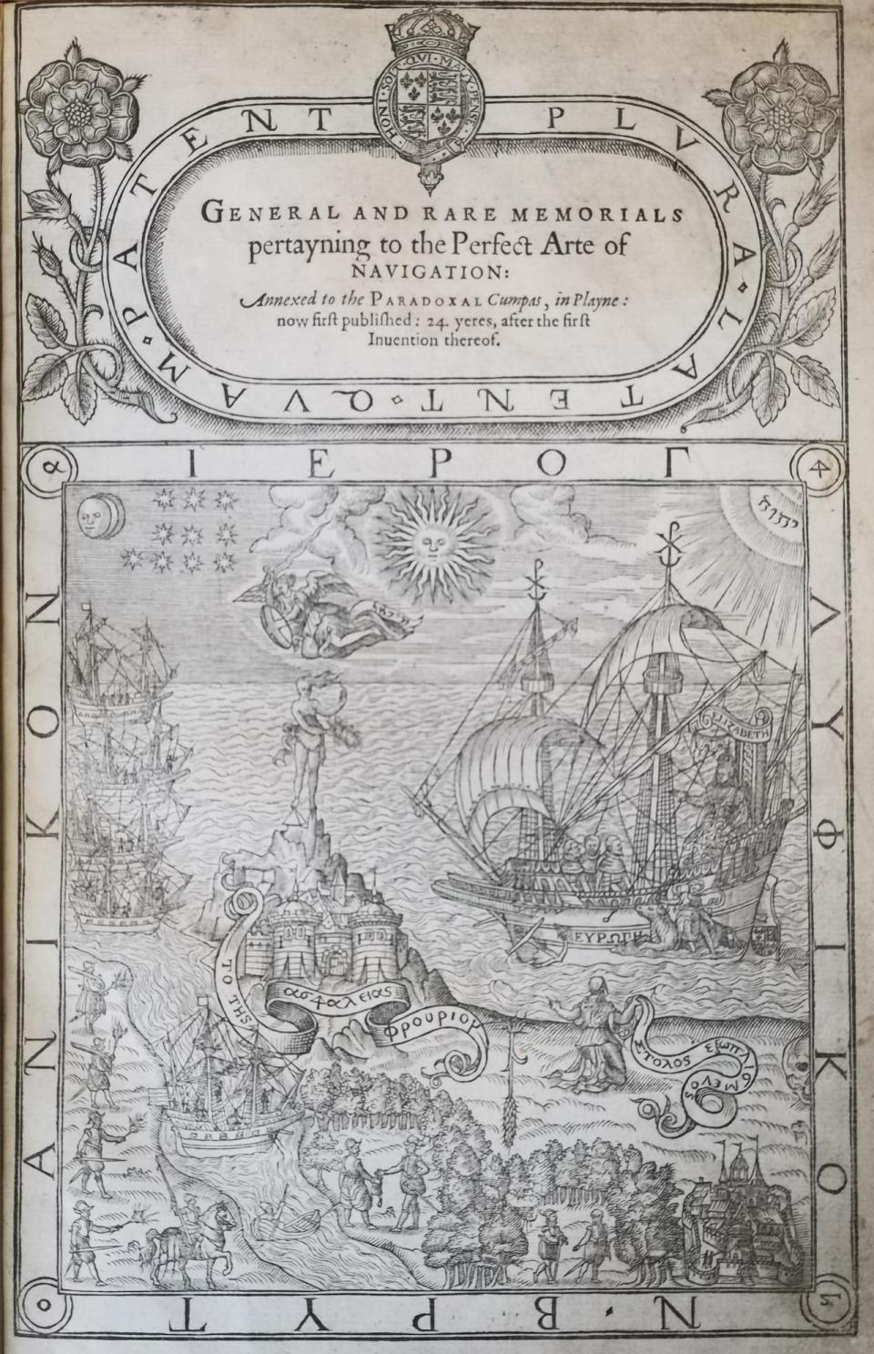
The cover of John Dee’s 1577 book on the art of navigation incorporates esoteric symbols, including the sun, moon, stars and a shining tetragrammaton, to symbolize divine approval of British imperialism under Queen Elizabeth I. (Royal Museums of Greenwich)
Ultimately, the Northwest Passage was discovered by chance in 1853 by Richard McClure and the crew of the HMS researcherwho were searching for Franklin’s lost expedition.
They sailed through the Strait of Magellan in South America to the Pacific and entered the Arctic Ocean from the west. So when the Investigator became trapped in the ice and were forced to abandon it, they continued east by sledge and were rescued by another British ship.
This second rescue ship also eventually had to be abandoned after becoming trapped in the ice, and everyone on board was forced to walk south to safety.
Although they had found the legendary Northwest Passage, they had disproved the theory of symmetrical geography, since, unlike its southern counterpart, the Northwest Passage was not reliably free of ice.
Download our free CBC news app to sign up to receive automatic alerts from CBC Newfoundland and Labrador. Click here to visit our home page.